

-
摘要:
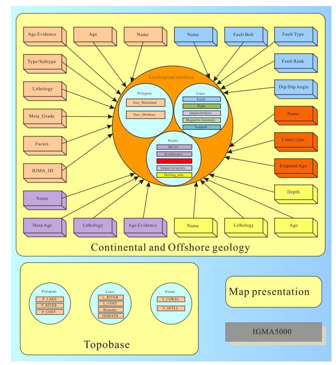
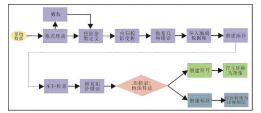
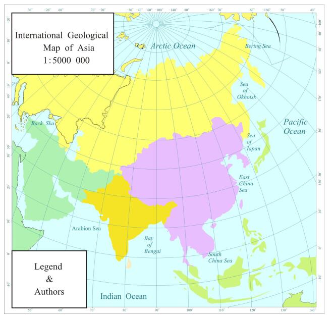
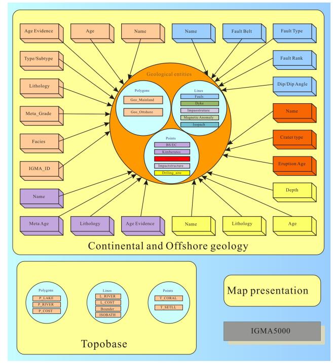
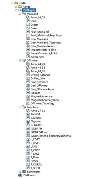
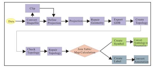
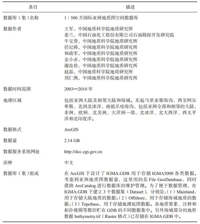
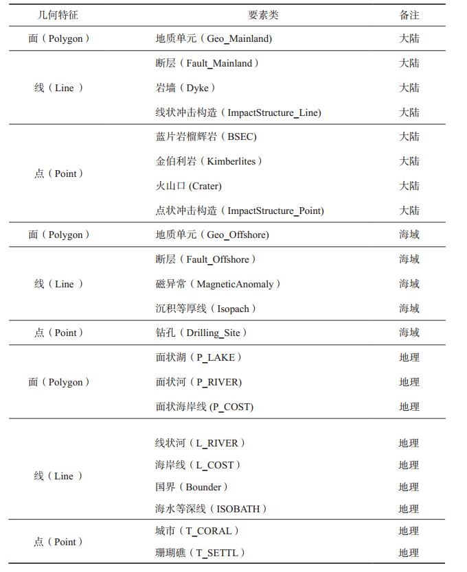
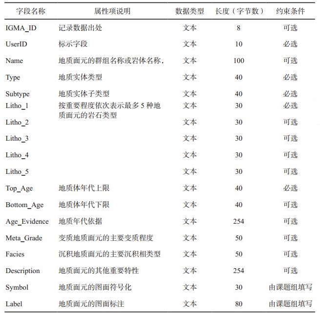
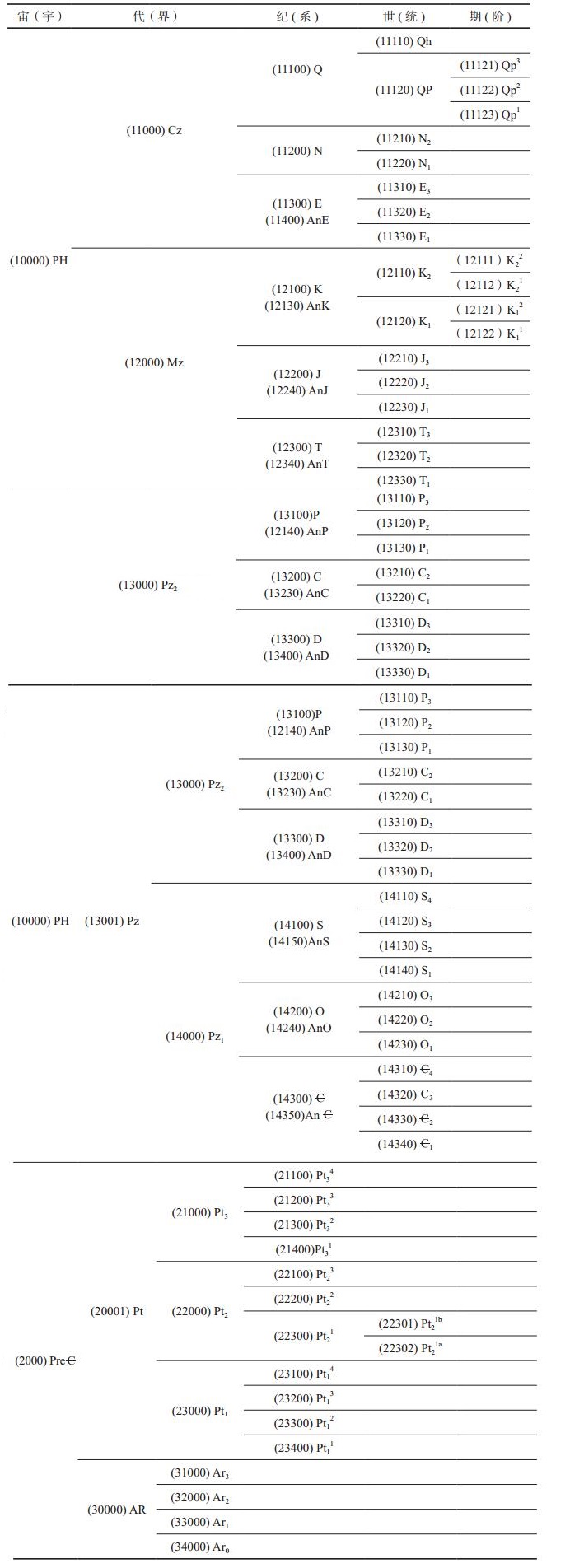
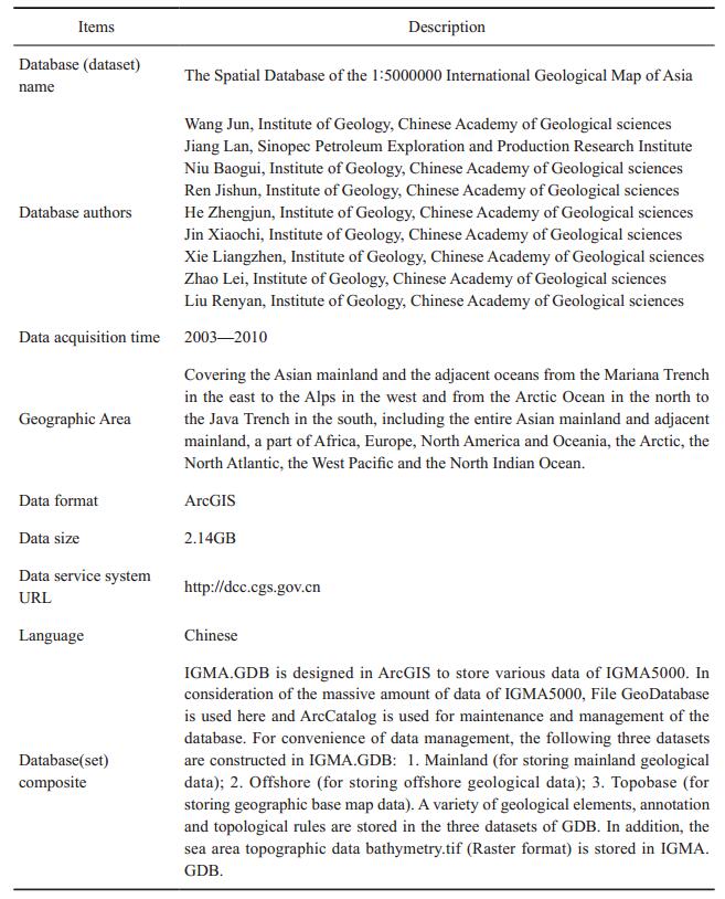
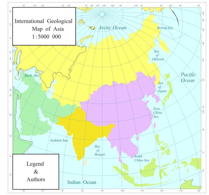
1:500万国际亚洲地质图(IGMA5000)是由世界地质图委员会(CGMW)的4个分会,亚欧20个国家的100余名地质学家合作完成的。它是第一幅全面反映亚洲大陆及相邻海域地质的IGMA5000;第一幅按CGMW和IUGS国际标准编制的IGMA5000;第一幅在ArcGIS平台上建有空间数据库并采用计算机辅助编图方法编制的IGMA5000。图幅西起阿尔卑斯,东到马里亚纳海沟,北起北冰洋,南到爪哇海沟,空间数据库的数据量达到2.14 GB。本文介绍了IGMA5000空间数据库的基本建设情况。IGMA5000的完成,为亚洲大地构造、成矿规律和资源环境研究建立了坚实的基础。
-
关键词:
- 1:500万国际亚洲地质图(IGMA5000) /
- 亚洲 /
- 世界地质图委员会 /
- ArcGIS /
- 空间数据库
Abstract:The 1:5000000 International Geological Map of Asia (IGMA5000) under the aegis of the Commission for the Geological Map of the World (CGMW) is a cooperative project which involves more than 100 geologists from 4 subcommissions of CGMW as well as geological surveys and institutions of 20 Asian and European countries. IGMA5000 is the first digital Asian geological map built on the ArcGIS platform and compiled in accordance with international standards and also the first map that displays the off-shore and on-shore geology within the map area, and therefore the compilation of the map is extremely arduous and challenging. The map area covers whole Asia and its adjacent regions from the Alps in the west to the Mariana Trench in the east, and from the Arctic Ocean in the north to the Java Trench in the south. The amount of data in the spatial database is 2.14 GB. The paper introduced the basic construction of ICMA5000. Its successful completion will surely lay a solid foundation for researches on the tectonics, metallogeny, resources and geological environment of Asia.
-
Key words:
- IGMA5000 /
- Asia /
- CGMW /
- ArcGIS /
- spatial database
-

-
任纪舜, 牛宝贵, 王军, 和政军, 金小赤, 谢良珍, 赵磊, 刘仁燕, 江小均, 李舢, 杨付岭.2013.亚洲1:500万地质图[J].地球学报, 34(1):24-30. doi: 10.3975/cagsb.2013.01.03
Ren Jishun, Niu Baogui, Wang Jun, Jin Xiaochi, Xie Liangzhen.2013.International Geological Map of Asia (1:5 000 000)[M].Beijing:Geological Publishing House.
Ren Jishun, Niu Baogui, Wang Jun, Jin Xiaochi, Xie Liangzhen, Zhao Lei, Liu Renyan.2013.Advances in research of Asian geology-A summary of 1:5M International Geological Map of Asia project[J].Journal of Asian Earth Sciences, 72:3-11. doi: 10.1016/j.jseaes.2013.02.006
Zeiler M. Modeling our world, The ESRI Guide to Geodatabse Design, Published by Environment System Research Institute, Inc., 380 New York Street, Redlands, California 92373-8100, 1999.
Ren Jishun, Niu Baogui, Wang Jun, He Zhengjun, Jin Xiaochi, Xie Liangzhen, Zhao Lei, Liu Renyan, Jiang Xiaojun, Li Shan, Yang Fuling.2013.1:5000000 International Geological Map of Asia[J].Acta Geoscientica Sinica, 34(1):24-30. https://www.researchgate.net/publication/286656319_15_million_international_geological_map_of_Asia
Ren Jishun, Niu Baogui, Wang Jun, Jin Xiaochi, Xie Liangzhen.2013.International Geological Map of Asia (1:5000000)[M].Beijing:Geological Publishing House.
Ren Jishun, Niu Baogui, Wang Jun, Jin Xiaochi, Xie Liangzhen, Zhao Lei, Liu Renyan.2013.Advances in research of Asian geology-A summary of 1:5000000 International Geological Map of Asia project[J].Journal of Asian Earth Sciences, 72:3-11. doi: 10.1016/j.jseaes.2013.02.006
Zeiler M. 1999. Modeling our world, The ESRI Guide to Geodatabse Design[M]. Published by Environment System Research Institute, Inc., 380 New York Street, Redlands, California 92373-8100
-
 下载:
下载:


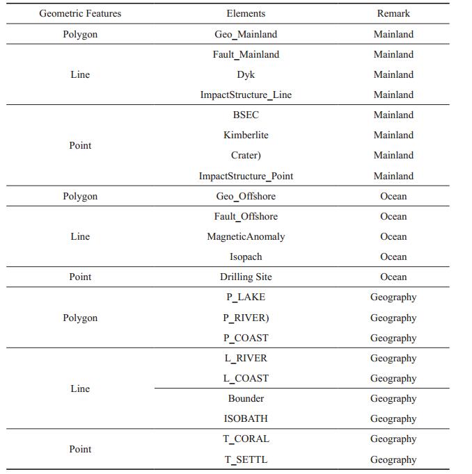
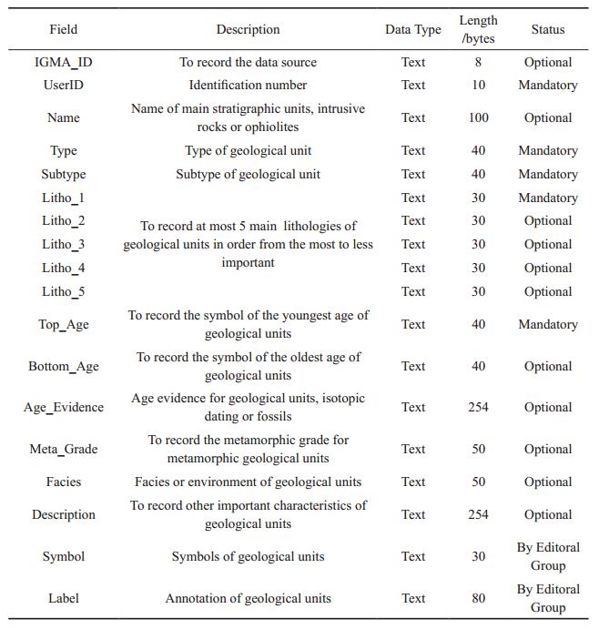
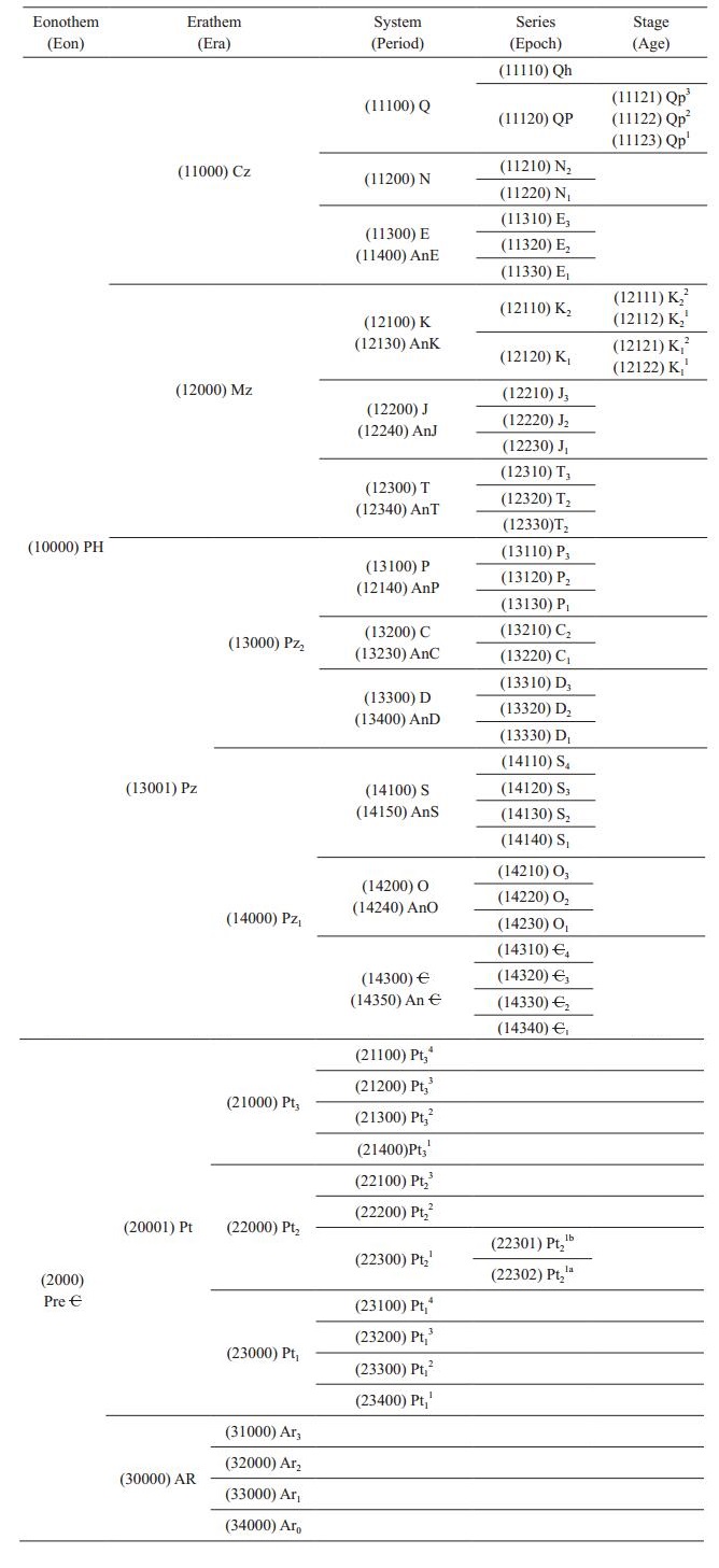
图(16)
表(8)
计量
- 文章访问数: 3757
- PDF下载数: 106
- 施引文献: 0